Buoys, marks and beacons and reserved areas
Find out how to be safe around buoys, marks and beacons in the Bay of Plenty.
Buoys and beacons
The waters of New Zealand are marked for safe navigation using the International Association of Lighthouse Authorities (IALA) A maritime buoyage system.
Buoys and beacons help guide boaties through shallow water, busy channels and past hazards. They are the ‘road signs’ on the water and the different shapes and sizes communicate important information about what side is safe to pass on.
Port hand markersWhen entering the harbour, channel or marina, the red port (left) mark should be kept on the boat’s port (left) side, and the green starboard (right) mark on the boat’s starboard (right) side.
|
 |
Starboard hand markersWhen leaving the harbour, channel or marina the red mark should be kept on the boat’s starboard (right) side, and the green mark on the boat’s port (left) side.
|
 |
Preferred channel to PortIf entering the harbour and approaching two channels, the preferred channel to port marker indicates which side the predominant channel is on. If you opt to take the preferred channel the marker should be kept on the boat’s starboard (right) side.
|
 |
Preferred channel to StarboardIf entering the harbour and approaching two channels, the preferred channel to starboard marker indicates which side the predominant channel is on. If you opt to take the preferred channel the marker should be kept on the boat’s port (left) side.
|
|
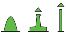
Isolated danger marksTo mark a small danger area with navigable water all around it. |
 |
Safe water marksThis does not mark a danger, but is used to mark mid channels or the beginning of a fairway. There is safe water all around the mark. |
|
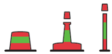
Special marksMarks an area of special significance such as a cable or pipeline, a military exercise area, a recreation zone or marine farm or marine reserve. |
 |
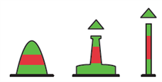
Cardinal markerThese marks indicate the side of any point of interest or danger on which it is safe to pass. The deepest water in that area is on the named side of the mark. |
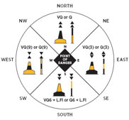 |
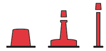
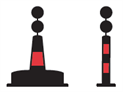
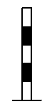
Reserved area markerA reserved area gives swimmers and Personal Water Craft (PWC) priority for certain activities such as skiing and jet skiing. Reserved areas are marked with black and white horizontal banded posts. |
 |
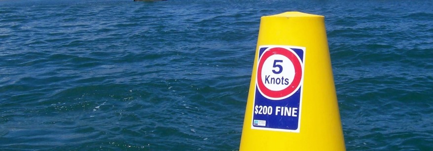
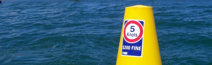
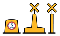
Waterski access lane markerYou may only ski from shore in a water ski access lane or reserved area; otherwise the 5 knot rule applies. Ski access lanes and reserved areas have no special status unless actually in use for skiing. Water skiers may exceed 5 knots within 200 metres of the shore within marked zones only.
|
 |
Exclusion zones
All previous directions relating to the closure of areas associated with the Rena salvage operation are withdrawn, with effect from 0800 NZST 05 April 2016.
From 0800 NZST 05 April 2016 the following areas are closed to vessels 500GT and over:
This notice is given by Peter Buell, Bay of Plenty Harbourmaster, in accordance with clause 3.11 of the Bay of Plenty Regional Navigation Safety Bylaw 2010 and section 33F(1) of the Maritime Transport Act 1994.
Any questions should be directed to the Bay of Plenty Harbourmaster on 0800 883 880.
Diving
 The Bay of Plenty has lots of recreational and commercial diving opportunities.
The following is a list of rules and recommendations:
- Always dive in pairs and have an observer in the boat.
- Do not dive in shipping lanes or areas of frequent traffic.
- Agree to a dive plan, and then adhere to it.
- Display the International Code A Flag from the dive boat.
- Do not exceed 5 knots within 200 metres of a Code A flag.
The Code A Flag means: “I have a diver down, keep well clear at slow speed”.
The dive flag must not be less than 600 mm by 600 mm in size and must be visible from a distance of 200 metres.
All craft must reduce speed to a maximum of five knots within 200 metres of a Code A Flag.
This flag may also be attached to a small marker buoy towed by a diver.
It may also be flown by craft escorting long distance swimmers.