Scroll through the various maps below for Tauranga, Rotorua Lakes and Whakatāne harbours.
Boating maps
Tauranga Harbour
The Tauranga/Mount Maunganui area is a popular holiday resort enjoyed by many who use its safe, sheltered waters for recreational activities like stand up paddle boarding, water skiing and kayaking.
Throughout the harbour there is an abundance of jetties, launching ramps, and ski lanes for small boat operators to use. Many reserve areas are adjacent to the harbour and where possible, boating facilities are provided.
Please remember that most of the land adjacent to the harbour is privately owned, so you should not land without permission.
During the summer season it is illegal to land on the forestry area of Matakana Island, except at designated ski areas or jetties.
Please respect and consider other users so everyone can use and enjoy our harbour.
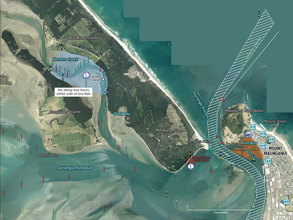
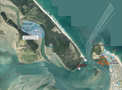
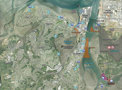
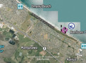
Scroll through six maps below for: Hunters Creek, Tauranga Harbour entrance and Pilot Bay; Tauranga Town Reach to Matapihi Ōmanu Beach; Kaituna River Tauranga; Ōmokoroa Beach Tauranga; Katikati entrance Tauranga; and Ongare Point.

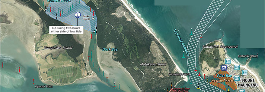
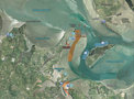
Hunters Creek, Tauranga Harbour entrance and Pilot Bay

Tauranga Town Reach to Matapihi

Ōmanu Beach

Tauranga, Ōmokoroa Beach

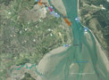
Tauranga, Katikati entrance

Tauranga, Ongare Point
Rotorua Lakes
The Rotorua lakes provide opportunities for a wide range of recreational activities, including boating, fishing, swimming, kayaking and more active sports like water skiing, jetskiing and power boating.
A number of commercial operators also use the lakes, providing charter boat hire and cruises. Recreational users undoubtedly make up the majority of users; visitors and day-trippers travelling locally, regionally and nationally to spend their leisure time at the lakes.
Scroll through the maps for nine lakes below: Lake Rotorua, Lake Rotoiti, Lake Rotoehu, Lake Rotomā, Lake Ōkataina, Lake Ōkāreka, Lake Tarawera, Lake Tikitapu, Lake Rerewhakaaitu.

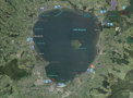
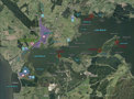
Lake Rotorua

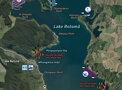
Lake Rotoiti

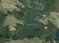
Lake Rotoehu

Lake Rotomā

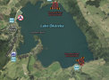
Lake Ōkataina

Lake Ōkāreka

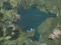
Lake Tarawera

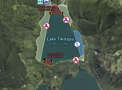
Lake Tikitapu

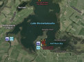
Lake Rerewhakaaitu
Whakatāne and Ōhiwa Harbour
The Whakatāne Harbour is a river port primarily servicing a commercial and charter fishing fleet. Because of its proximity to rich inshore fishing grounds, the port also provides access for up to 15,000 pleasure craft movements annually.
Ōhiwa Harbour lies 11 kilometres east of Whakatāne. Small boat operators should seek advice from regular users of the entrance or physically take a look at the bar at low water. Reasonable depths of water are maintained naturally within the channels.
There are numerous sandbanks within the harbour that do not dry at low tide and small boat operators should exercise caution when navigating within the harbour.
Ōhiwa Harbour is a very popular recreational waterway and various activities have been segregated to allow enjoyment by all. Please read the information signs at the boat ramps.
Scroll through three maps below for: Thornton, Rangitāiki River and Whakatāne River Entrance; Ōhiwa Harbour; and Lake Aniwaniwa.

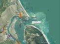
Thornton, Rangitāiki River and Whakatāne River Entrance

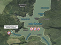
Ōhiwa Harbour

Lake Aniwaniwa